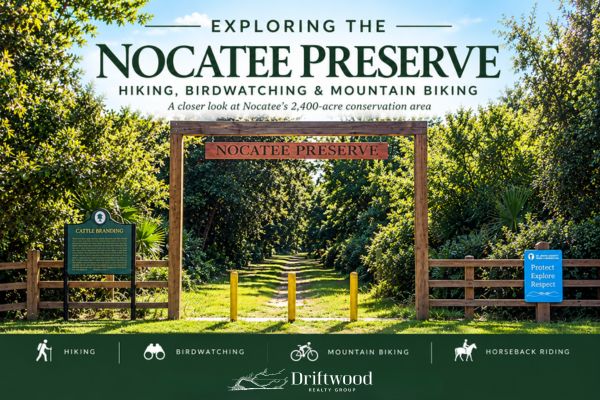
Nocatee Preserve: Hiking, Biking & Birdwatching
Nocatee is known for its paved greenway trails, golf carts, parks and carefully planned neighborhoods. But tucked along the eastern side of the community is something completely different: 2,400 acres of preserved Florida wilderness.
The Nocatee Preserve stretches along the Tolomato River, part of the Intracoastal Waterway, and provides a surprisingly wild contrast to the community surrounding it. It is a public St. Johns County park, not a residents-only Nocatee amenity, and its unpaved trails are used for hiking, running, mountain biking, birdwatching, photography and horseback riding.
I've hiked the Preserve with my daughters before, but I recently went back to the northern trailhead to see what conditions look like today.
I didn't get very far.
We weren't dressed for an actual hike, and it didn't take long to find wet, muddy conditions. That's probably the most useful thing I can tell someone who has only experienced Nocatee's paved greenway trails:
Don't assume the Nocatee Preserve is another version of the Greenway. It isn't.
What Exactly Is the Nocatee Preserve?
The Preserve encompasses approximately 2,400 acres along the Tolomato River and protects a remarkably large piece of natural Northeast Florida habitat beside one of the region's largest master-planned communities. Nocatee describes the land as fronting approximately 3.5 miles of the Intracoastal Waterway, while St. Johns County manages it as a public conservation and recreation area.
That distinction matters.
Nocatee has thousands of acres of preserved land and greenways woven throughout the community, but the Nocatee Preserve is a specific public conservation area. It isn't the same thing as the paved and multi-use paths connecting Nocatee's neighborhoods, parks and Town Center.
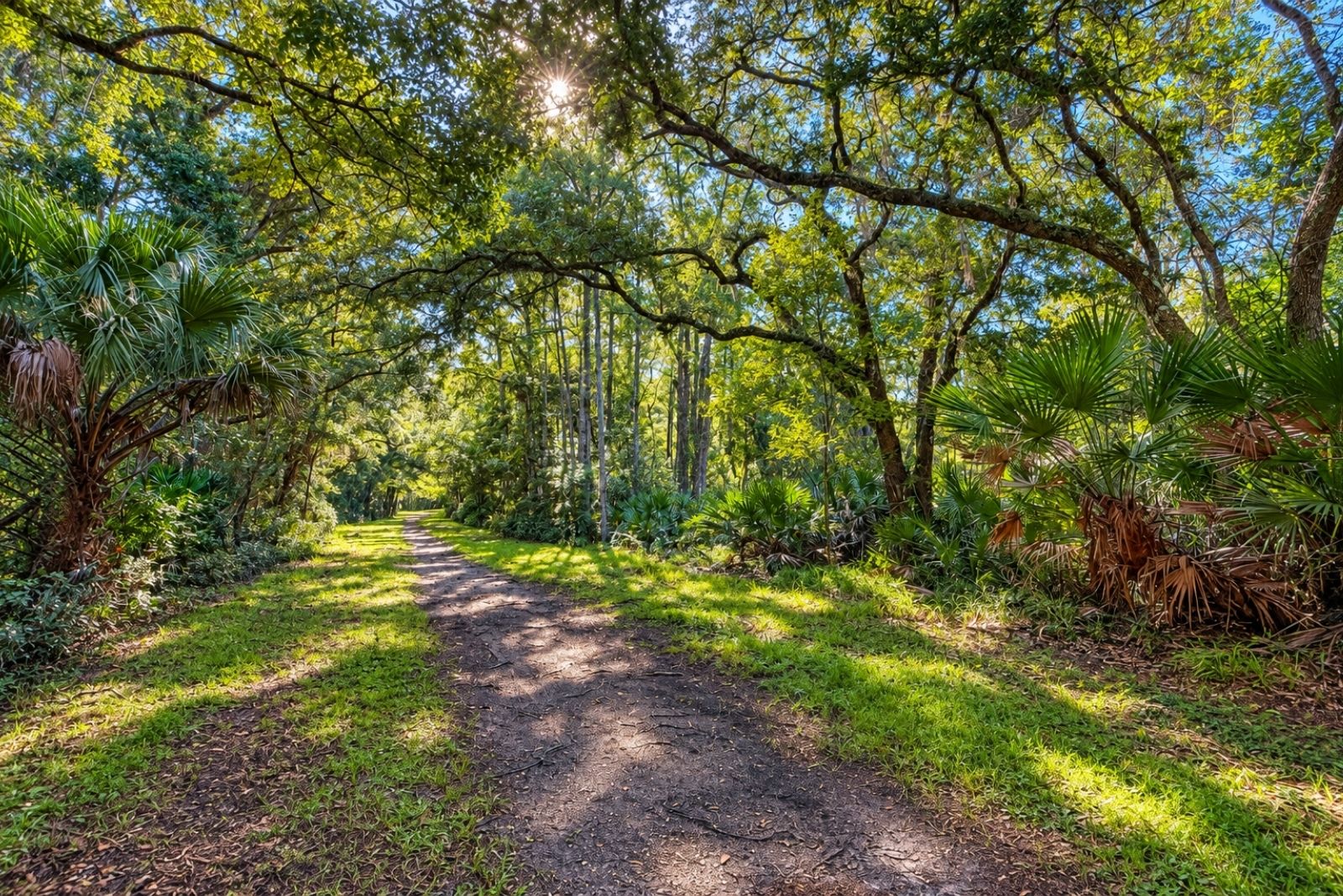
Here, the landscape includes wet flatwoods, floodplain forest, cypress swamp and estuarine habitat.
And when you're standing in it, that difference is pretty obvious.
Finding the Northern Trailhead
The northern trailhead is located at 501 Davis Park Road, behind Ponte Vedra High School and Davis Park.
You don't simply happen upon it while driving through Nocatee. You intentionally continue toward the back of the Davis Park/Ponte Vedra High School area until the road ends at the Preserve entrance.
There is parking, a restroom facility and trail information at the northern trailhead. The Preserve is currently open from dawn to dusk.
And before you even enter the trail, there's something worth stopping to read.
The Land Has a History Much Older Than Nocatee
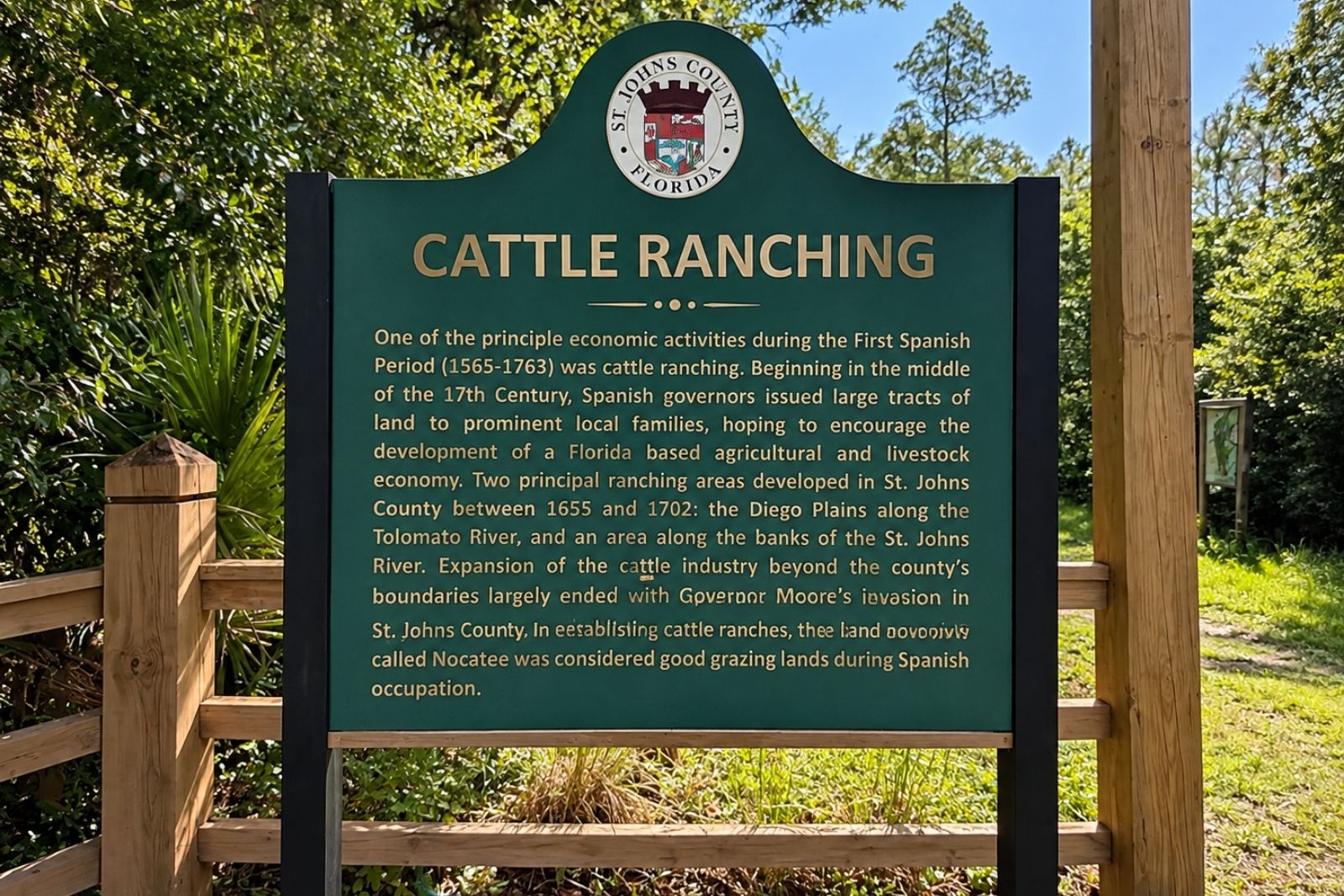
One of the most prominent signs at the trailhead has nothing to do with hiking.
It's about cattle ranching.
According to the St. Johns County historical marker, cattle ranching was already an important economic activity here during Florida's First Spanish Period. Beginning in the mid-1600s, Spanish governors granted large tracts of land to encourage agriculture and livestock production, and the land now known as Nocatee was considered good grazing land during the Spanish occupation.
I love that this marker is sitting at the entrance to the Preserve because it puts the landscape into perspective. Long before there were Nocatee neighborhoods, water parks, schools or golf carts, people were using this land in completely different ways.
The cattle story also reaches much farther into Nocatee's history through the Davis family's Dee Dot Ranch.
I've gone deeper into that history in The History of Twenty Mile, including the greater area land's ranching history and how it eventually became part of the Nocatee we know today.
This Isn't a Greenway Trail
If you're accustomed to Nocatee's wide paved and multi-use paths, this is where expectations need to change.
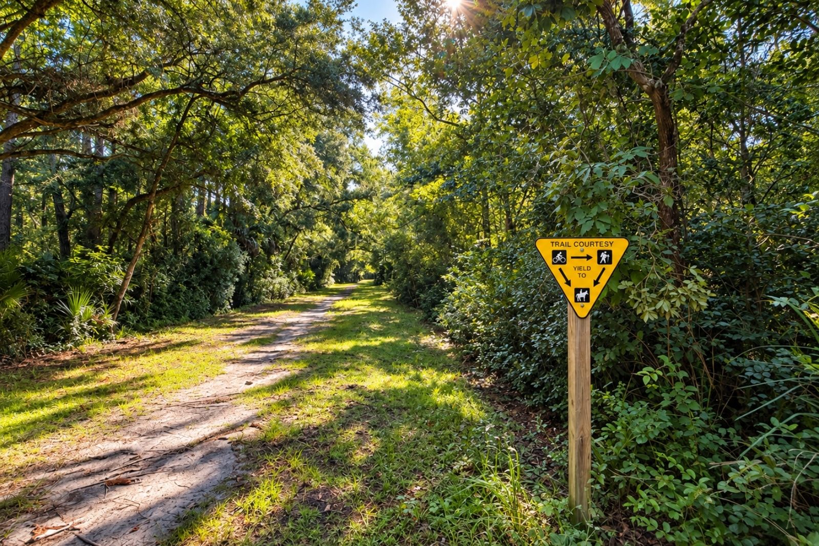
The main Preserve trail is unpaved.
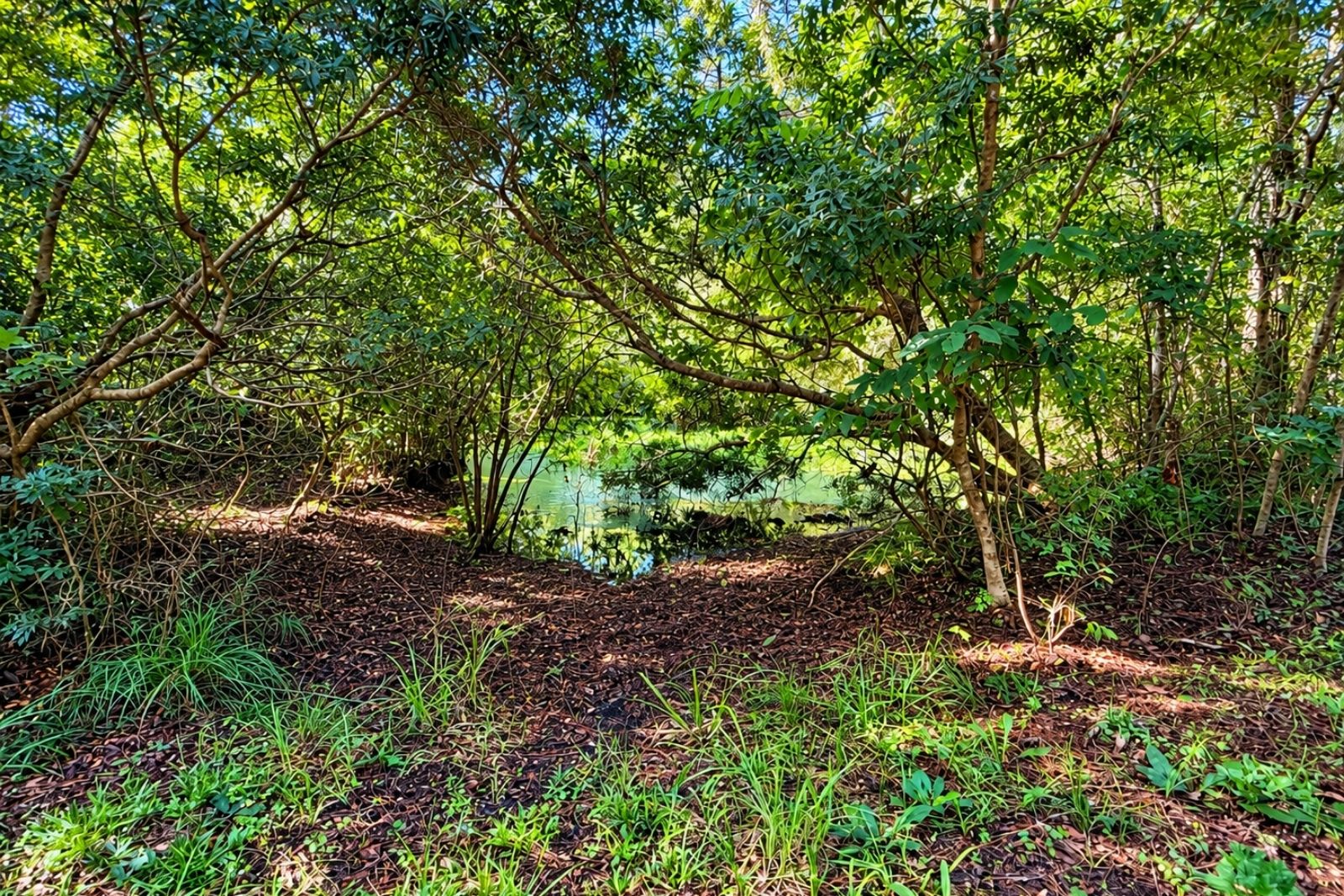
When my daughters and I hiked here several years ago, portions of the trail were heavily vegetated and extremely wet. We crossed areas of standing water and encountered both a snake and an alligator along the way.
When I returned recently, I found wet and muddy conditions again without going very far beyond the trailhead.
That doesn't mean the trail always looks that way. Conditions can change considerably with rainfall and the time of year. But this is preserved Florida habitat, not a manicured recreation trail.
St. Johns County Audubon identifies several habitat types here, including cypress swamp, floodplain forest, wet flatwoods and estuary. In other words, encountering water isn't necessarily an anomaly. It's part of the landscape. (St. Johns Regional Audubon -)
I'd come prepared for that.
The Preserve Is a Shared Trail
Another thing that's easy to miss if you've never visited is that this isn't exclusively a hiking trail.
Walking and running share the Preserve with mountain biking and horseback riding. The trail-courtesy sign near the entrance is a good reminder to be aware of who else may be approaching, particularly where vegetation limits your view. St. Johns County currently lists walking, jogging, mountain biking and horseback riding among the permitted uses.
Mountain Biking in the Nocatee Preserve
Mountain biking has its own place in the Preserve.
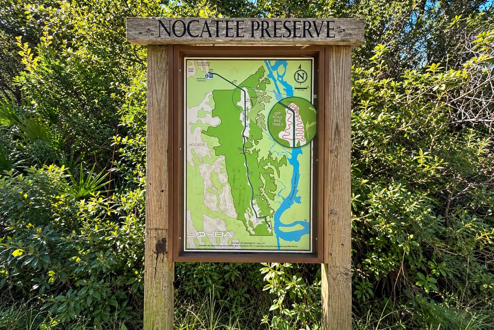
The trailhead map identifies separate off-road bike trails branching from the main route, and the County's current trail map separately identifies a Preserve Mountain Bike Trail. Its 2025 map measures that route at approximately 3.84 miles. (St. Johns County)
How Long Is the Nocatee Preserve Trail?
This is one place where I wouldn't give you a single mileage and send you on your way.
Different maps and sources measure different portions of the Preserve trail system.
St. Johns County Audubon's Preserve profile describes a 3.5-mile one-way route from the northern trailhead near Ponte Vedra High School to Nocatee Landing. Meanwhile, St. Johns County's newer June 2025 trail map labels the Preserve Trail Road at 5.13 miles and the separate mountain-bike trail at 3.84 miles. (St. Johns Regional Audubon -)
That's why I recommend checking the current posted map when you arrive and planning your route based on how far you actually want to go.
And remember, if you're walking an out-and-back route, whatever distance you travel into the Preserve still has to be traveled again to get back to your car, so plan ahead.
Bring Your Binoculars
The Nocatee Preserve is also a legitimate birding destination and you can hear a variety while on the trail.
St. Johns County Audubon's Preserve profile reports 167 bird species observed and identifies everything from hawks, owls and woodpeckers to warblers, herons, egrets, ibis, cormorants and Wood Storks. Audubon identifies January through May as particularly good months to visit for birding. (St. Johns Regional Audubon -)
The variety makes sense when you look at the landscape. As the trail moves through wooded areas, wetlands and toward the Tolomato River, the habitat changes too.
If wildlife is what interests you most, I've written separately about Nocatee Wildlife, including some of the animals we regularly see throughout the community.
Wildlife Beyond the Birds
This is Florida, and the Preserve is wildlife habitat.
Deer, wild hogs, turkeys and snakes are among the wildlife documented in the Preserve.
And, as I mentioned earlier, I've personally encountered both a snake and an alligator while hiking here.
That isn't something I say to scare people away. It's the opposite. One of the things that makes the Preserve so interesting is that it really is preserved habitat.
But I would treat it accordingly.
The Southern End: Nocatee Landing
Follow the Preserve south and you eventually reach an entirely different landscape.
Nocatee Landing sits at the southern trailhead beside the Tolomato River and provides an open-air pavilion, parking, restrooms and access for launching non-motorized watercraft.
It's one of my favorite examples of how Nocatee's preserved land and waterways connect. You can begin in dense woods near Ponte Vedra High School and ultimately reach the Intracoastal.
Nocatee Landing deserves its own article, so I'll take you there separately rather than trying to squeeze everything about it into this one: Nocatee Landing: Where Nocatee Meets the Intracoastal
Before You Go
This is one Nocatee outing I would prepare for rather than deciding to do spontaneously.
Wear shoes that can handle mud and water. Bring drinking water and insect repellent. Keep your phone charged. Pay attention to wildlife and to cyclists or horses sharing the trail.
And give yourself plenty of daylight.
Because portions of the Preserve can feel quite isolated, I personally wouldn't hike it alone, and I wouldn't plan a route that leaves me trying to find my way back near sunset.
The park itself is open dawn to dusk.
Today's visit reinforced that for me. We were dressed for taking pictures, not hiking, and the wet conditions were enough for us to decide that we'd seen what we needed to see and turn around.
Sometimes knowing when you aren't prepared for the trail is part of being prepared for the trail.
Why the Nocatee Preserve Matters
It's easy to think of Nocatee in terms of houses, water parks, schools and Town Center.
The Preserve tells another part of the story.
As Nocatee was being planned, approximately 2,400 acres along the Intracoastal were set aside for the county Preserve. Today, that land remains publicly accessible conservation land beside a community that has grown dramatically around it.
Standing there today, that's what struck me most.
You're only minutes from neighborhoods, schools, restaurants and some of Nocatee's busiest amenities. Then you walk beneath the trees and suddenly you're looking at muddy trails, standing water, palmettos and dense woods.
It doesn't feel like another Nocatee amenity.
It feels like a piece of old Florida that Nocatee grew up beside.
And I think that's exactly why it's worth exploring.